 [Summary] [Summary] |
Oléron island |
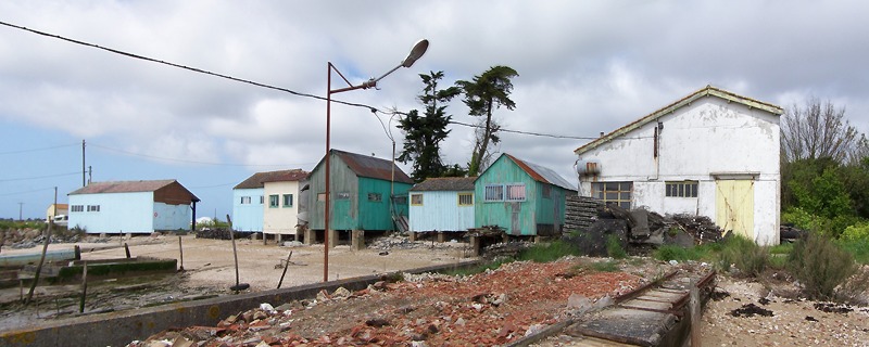 |
This is the largest of the four islands. As flat as Ré (max. height 34m), it shows the same kind of coastal arrangement: wild and rocky in the west, muddy and farmed in the east. Oyster-bungalows at the Château d'Oléron (spot 07). |
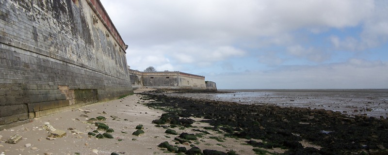 |
The Citadel, from the end of the XVII th century, facing the bay and its wide mud flats. |
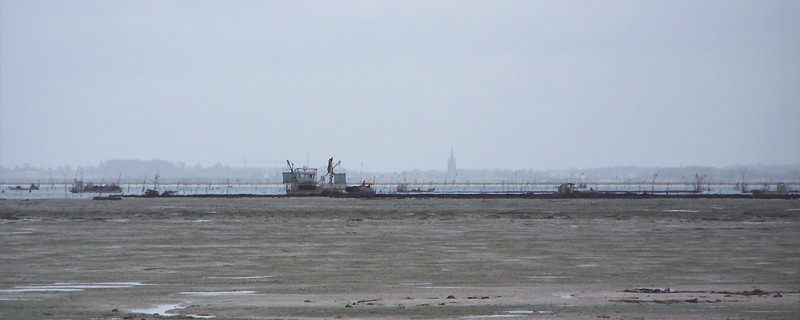 |
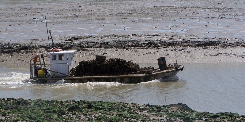
Oyster-farmers at work offshore at low tide. |
 |
| A "ponton", back to the harbour with its deck filled with mussels. |
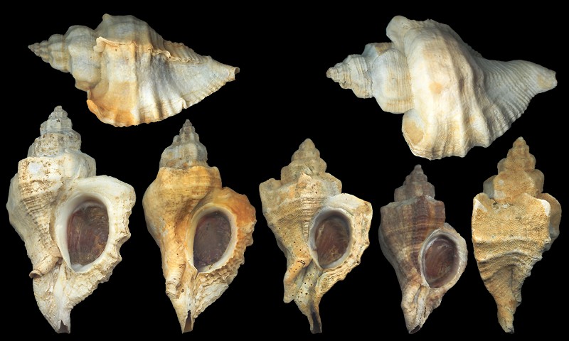 |
| Subfossil Pteropurpura inornata (Récluz, 1871), discarded, near the harbour, among grass and dead mussels. 41-55mm. |
| Western coast: wildlife on the Vincentes |
| |
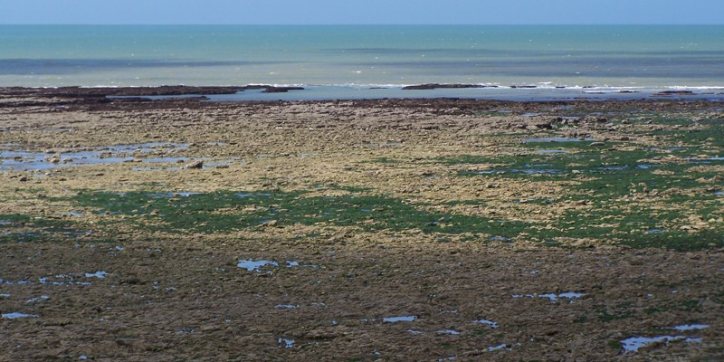 |
Spot 08. One can distinguish four areas, from the shore to the subtidal level: the first, near the beach, is the kingdom of Patella vulgata; the second, yellow with green algae, is colonized by boring bivalves, Gibbula umbilicalis and pennanti; the third, grey and relatively dry, is covered with Crassostrea gigas and Nucella lapillus; the last one, under the brown algae, is the upper part of Ocenebra erinaceus's territory. A fishing-pool lays at left of the image: Les Rabaudes. |
 |
The sandy beach and the forest, seen from lower intertidal. The wall, at right, is cemented by wild oysters. |
 |
Les
Rabaudes. Many molluscas crawl in these pools. |
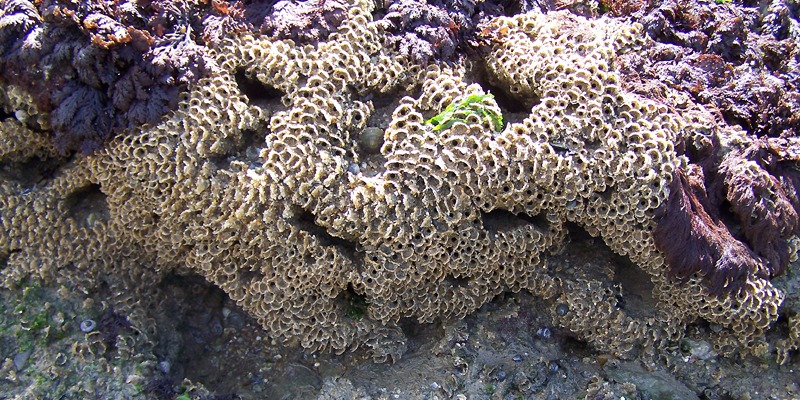 |
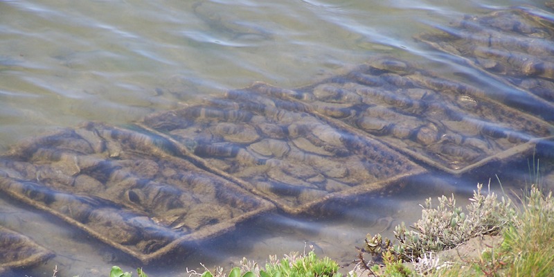
A precious worm: the "hermelle", Sabellaria alveolata (Linnaeus, 1767). Honeycomb worms are elegant contributors to recifal reinforcment. One of the widest cities is located in Mount St-Michael's bay, NE. Brittany: 90ha, 220 acres in 1999! |
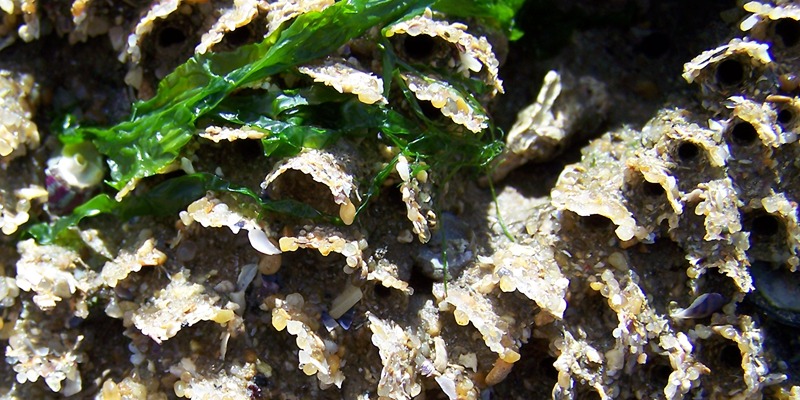 |
Detail of a few tubes. Human activities (digging, walking) are the first causes of mortality. Storms come far behind. |
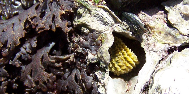 |
A marvelous Nucella lapillus f. imbricata, sleeping in an empty oyster, on the wall of a pool. |
 |
Ocenebra
erinaceus in the wind. |
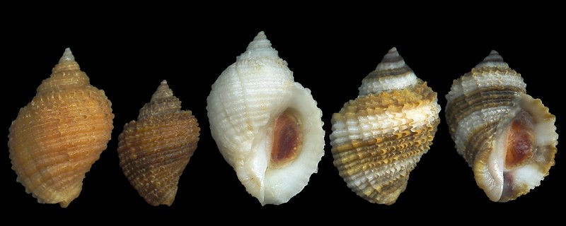 |
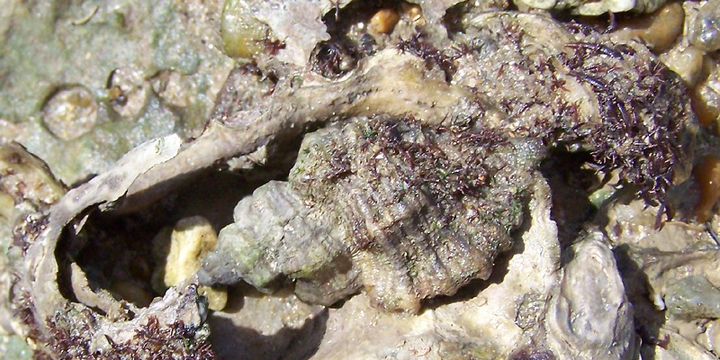
Nucella lapillus. 16-24mm. Life in sheltered areas (dead oysters, crevices in wall), and youth, promote scaly sculpture. 17-24mm. It appears that shells living on rocks exposed to waves tend to be smoother, and thicker. |
| Oyster-cities on the eastern coast |
| |
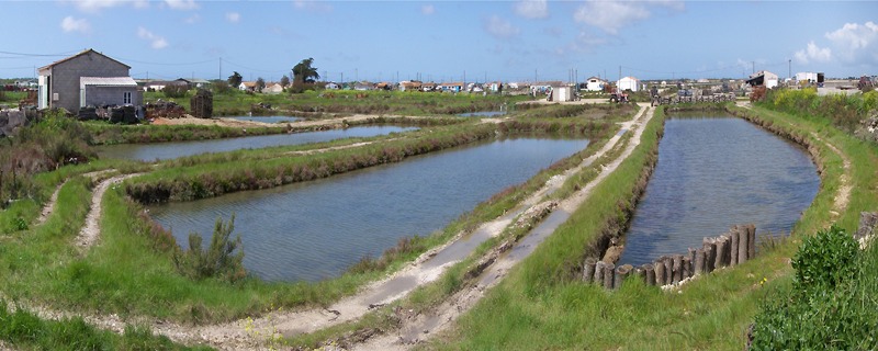 |
Spot 09. The "claires" are these salt-water ponds in which farmers put their oysters once the shells reached their fourth year. In all the country around Dolus, thousands of acres of claires were dug in the argillaceous ground. All the houses on the pictures are packaging-shops. During low tides, everyone is offshore, on the banks, and the whole city is deserted. |
 |
Oysters
in maturation in a pond. Two vintages are acknowledged: fines de claire,
and spéciales de claire, according to the time the shells
spend in the pools. The water is changed every flood-tide, in order to
keep the density of phytoplancton at a decent level. These shells are
great filters. |
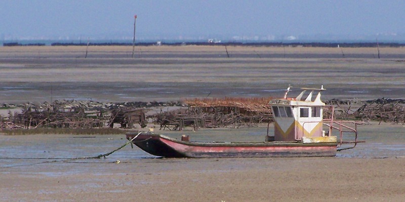 |
A "ponton" asleep in the mud, near the channel of la Baudissière. The maturation in claires gives the molluscs a finer taste, avoids most of the parasitism, and authorizes larger sizes. Ten thousands people work in the Marennes-Oléron basin. |
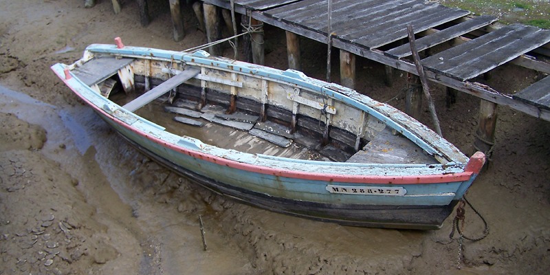 |
Spot 10. Old boat at low tide in a channel at Fort-Royer, a little oyster-village south of Boyardville. |
| Facing the north, Saumonards beach |
| |
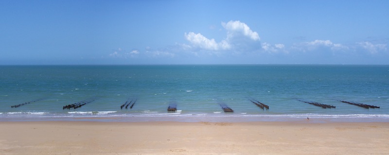 |
Spot 11. Oyster parks and bouchots off the beach, facing the north. Ré island is on the sky-line, under the cloud. |
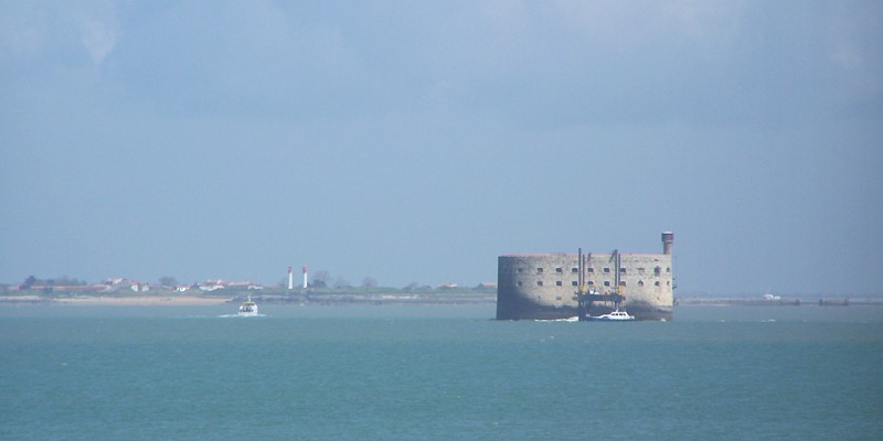 |
Turning east, the visitor discovers Aix island with is twin lighthouses. In the middle of the strait between Aix and Oléron, here is Fort-Boyard. This stronghold was built on a sand-bank, the "longe de Boyard", in order to protect Rochefort area. The first thing to do was to sink tons of large rocks before building anything (1801-1848). The fortress was completed in 1857. Unfortunately, at this date, the guns reached such long ranges that Fort-Boyard became useless. |
 |
Spot 12. 68m long, 31m wide. The walls reach the 20m above sea level. The bigger waves come from the right. |
| Where do you wish to go now? |